Art Custom Framing Gallery Los Cabo San Lucas, San Jose del Cabo, Mexico

Vintage Antique Maps of Baja California, México, are pictures of the old world's cultural beliefs and perceptions and document the social, political, and economic times in which they are produced.
Need Fine Art Custom Framing and Paintings in Los Cabos, San Jose del Cabo or Cabo San Lucas, see Davinvi Marco and picture framing with two locations. We can proide you with archival museum conservation framing at our Art Galleries discounted and competitive pricing.
Look for lmore interesting things on the website included Old photos of Cabo San Lucas and Satellite images of baja and a link for you to find more.
Maps serve many more purposes besides showing us how to get from one point to another. They are at once artistic, scientific, and technological creations with more than one level of meaning. Maps are pictures of the world reflecting a people's cultural beliefs and perceptions and document the social, political, and economic times in which they are produced.
Maps are not neutral instruments. Beyond providing topographical information, they represent attempts to claim and control land and inhabitants. Instruments of persuasion, maps speak to us about places, people, events, their makers, and their makers' motives.
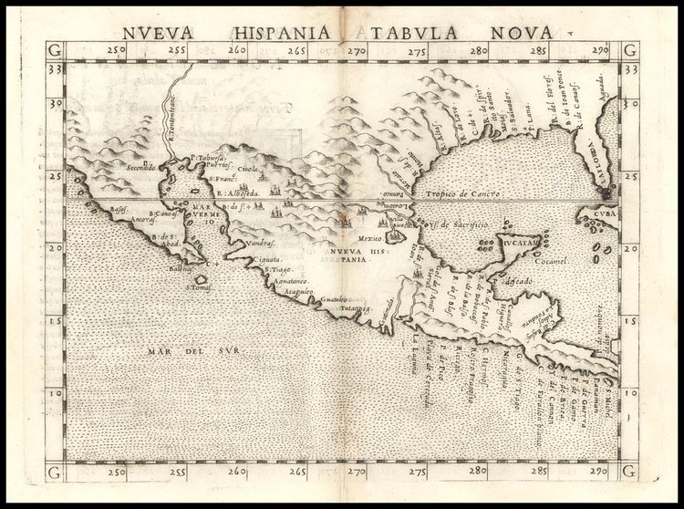 Map1562 by this map http://www.raremaps.com
Description: Ruscelli's map is an enlarged version of Giacomo Gastaldi's map of 1548, except that the
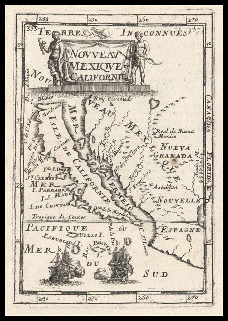
 Map 1660 to buy this map http://www.raremaps.com
Description: Rare map of California as an island, the second earliest map to focus on just California and the contigouous coastal regions, after Sanson's map of 1657. Identifies numerous place names on the west coast, inclduing Drake's Bay,
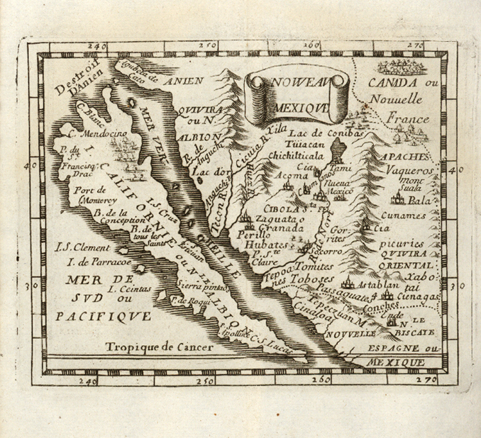
 Map 1683 to buy this map http://www.raremaps.com
Description: First regional map of
Description: Perhaps the most famous of all miniature maps of
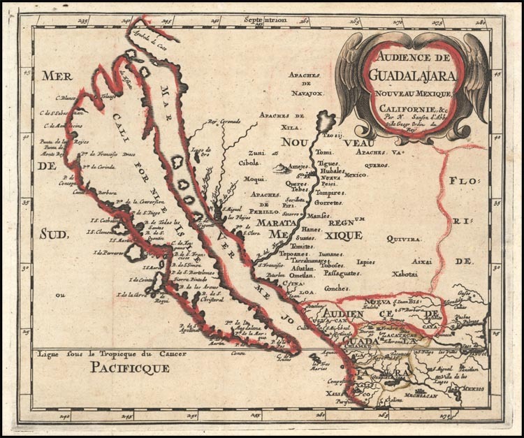
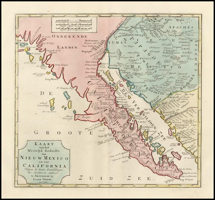 Map 1765 to buy this map http://www.raremaps.com
Description: One of the best mid 18th Century maps of
 Map 1779 Current Value $400.00 USD contract for more information
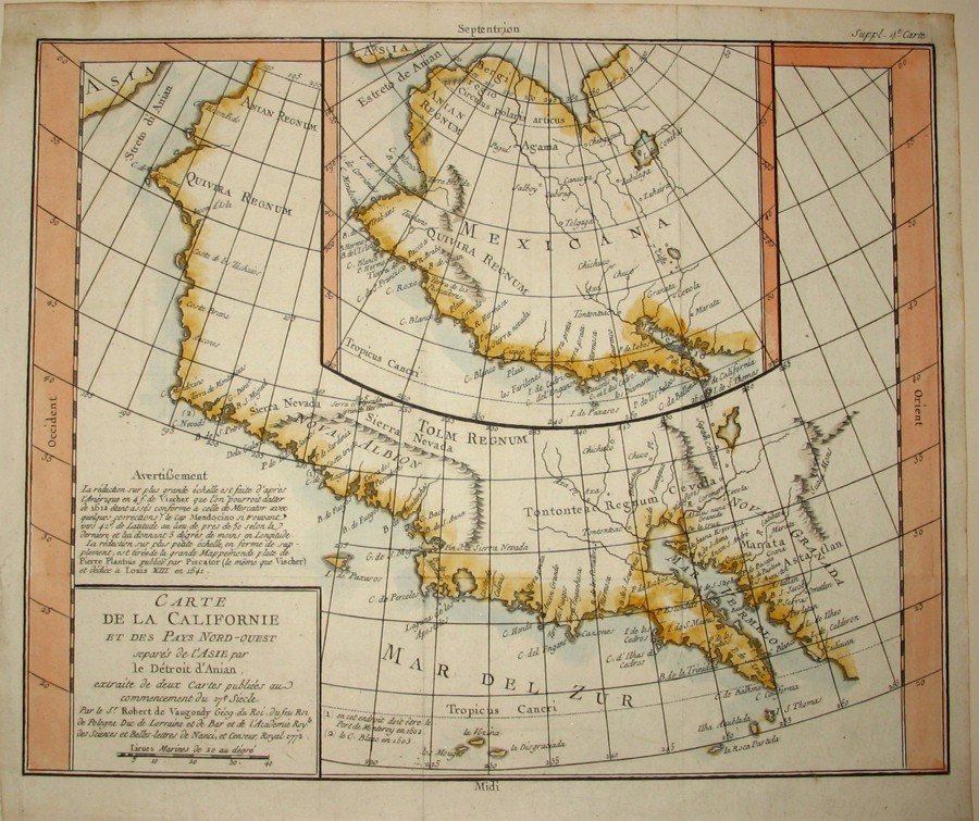
 1730-1740 Current Value $2,500.00 U.S.D.contact for information
Seutter, Mattheus (1678-1757).
Matthias Seutter was born in Augsburg in Southern Germany. He began as an engraving apprentice for Johann Baptist Homann. In 1707 he started his own cartographic printing company in Augsburg. Matthias Seutter produced maps, globes (starting in 1710) and atlases (starting in 1728). He became the official imperial geographer of Charles VI. After his death, the business was continued by his son Albrecht Karl (1722-1762) and his son-in-laws, Conrad Tobias Lotter and G.B.Probst. Around 1757/58 Lotter became the sole owner of the company. He removed the name of Seutter from the original plates and replaced it by his own.
Novus Orbis sive America Meridionalis et Septentrionalis... Augsburg, J.M. Probst, 1784. Original wash colour with additions. 500 x 585mm.
North & South America, engraved for Seutter by Gottfried Rogg. California is shown as an island, and one of the two huge coloured cartouches hides the lack of information about the northwest. McCLAUGHLIN: 211, state 4 of V.
 1787 Current Price $500.00 U.S.D. contact for information
Rigobert Bonne, (1727 – 1795, was one of the most importantcartographers of the late 18th century.
In 1773 Bonne succeeded Jacques Bellin] as Royal Cartographer to France in the office of the Hydrographer at the Depôt de la Marine. Working in his official capacity, Bonne compiled some of the most detailed and accurate maps of the period. Bonne’s work represents an important step in the evolution of the cartographic ideology away from the decorative work of the 17th and early 18th century towards a more detail oriented and practical aesthetic. With regard to the rendering of terrain Bonne maps bear many stylistic similarities to those of his predecessor, Bellin. However, Bonne maps generally abandon such common 18th century decorative features such as hand coloring, elaborate decorative cartouches, and compass roses.
While mostly focusing on costal regions, the work of Bonne is highly regarded for its detail, historical importance, and overall aesthetic appeal.
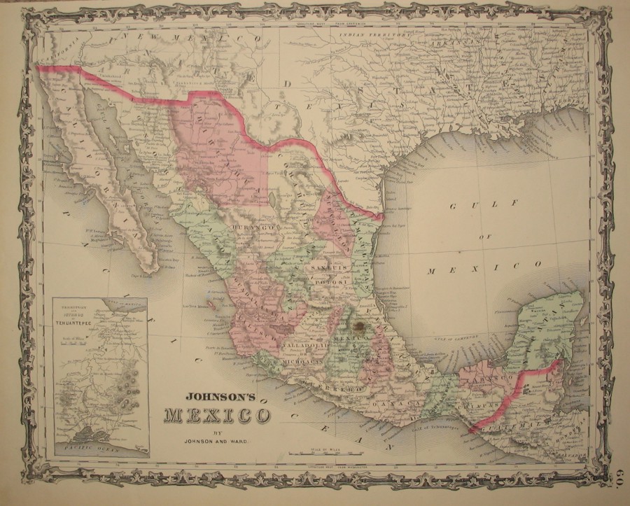 1862 Current value $250.00 U.S.D. contact for information
Description Johnson Map of
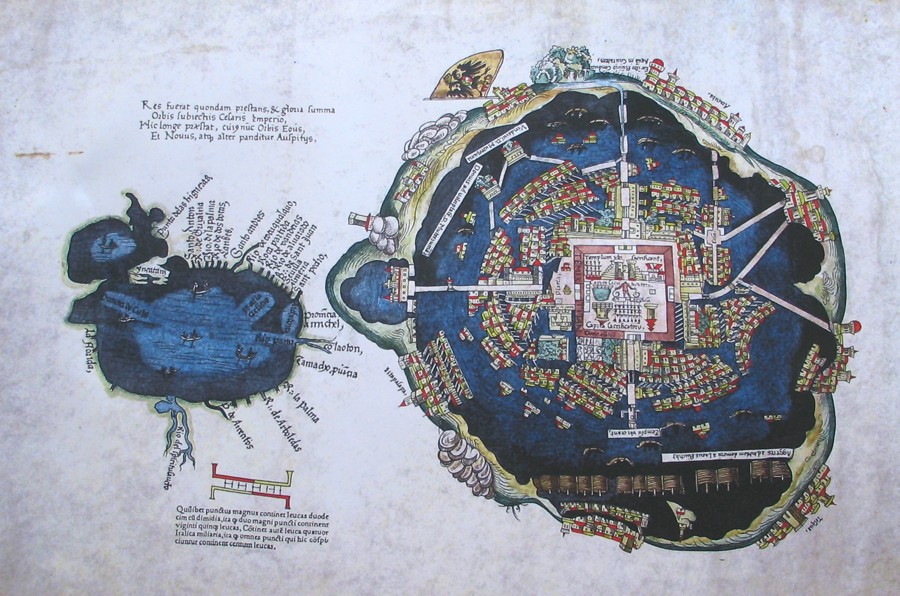
Map of Mexico city when the Aztecs were in charge
View My Stats